Cartos is the common engine. Industries run over it as licensed editions — each a
switchable catalogue of department modules over the same data fabric, agent, and shell.
Nine editions ship today: Government (Atlas), Electric Utility (Grid), Airport
(Tower), Transportation (Milepost), Infrastructure Delivery (Blueprint), continental
Government (Africa), critical-infrastructure protection (Guardian), and reactive crisis
monitoring (Sentry), and Agriculture Intelligence (Harvest) — each licensable as its own sovereign instance.
One platform, nine industries, 67 individual department modules.Cartos Guardian and Cartos Sentry are a deliberate pair —
proactive strike-risk protection feeding a reactive change-detection monitor — now live at
guardian.cartosatlas.com and
sentry.cartosatlas.com. Cartos Harvest went live at
harvest.cartosatlas.com on 29 July 2026.
The model
Engine → editions → instances.
Build the hard part once — the sovereign substrate, the agent, the shell — then re-skin and re-catalogue it per industry. A new vertical is a slice, not a fork; a new customer is an instance, not a rewrite.
The engine
One Rust core + web shell: tenant- and team-isolated data fabric, a built-in AI agent, MapLibre 2D and Cesium 3D, and the admin, theming, and capability systems every edition inherits.
The editions
Each edition is a curated set of department modules for one industry — its own default theme, its own catalogue, its own sample geography. Turn modules on and off per client.
The instances
An edition can be licensed to more than one party as a separate sovereign instance — its own tenant, data, and identity, all in-territory.
Live today
Nine editions live. 67 department modules.
Every edition below runs on the same substrate, with real operational data seeded per module, KPI dashboards, and the ask-the-map agent — each reachable on its own sovereign subdomain. Four of the nine were built in the last six weeks. Every screenshot on this page is the running product, not a rendering.
Government edition
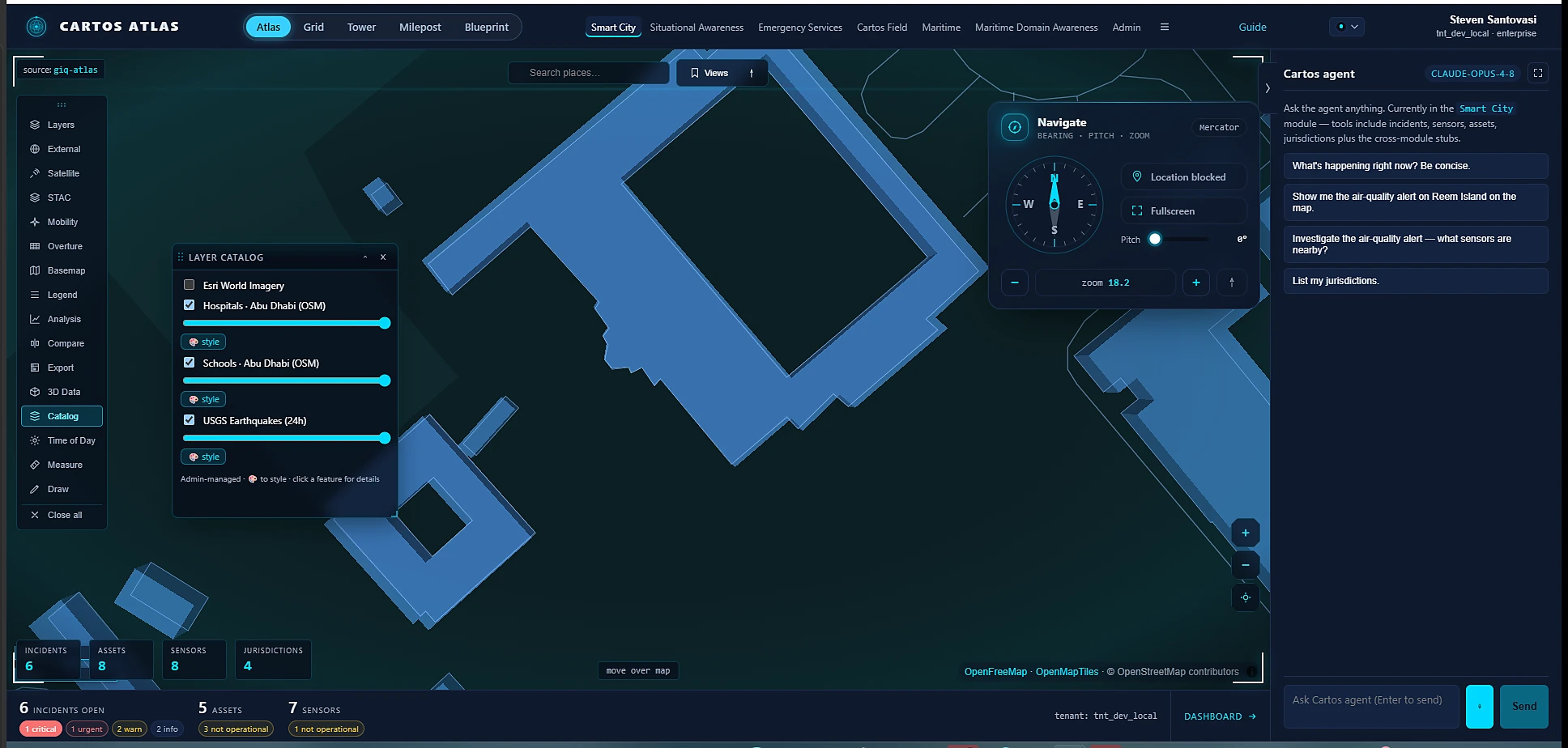
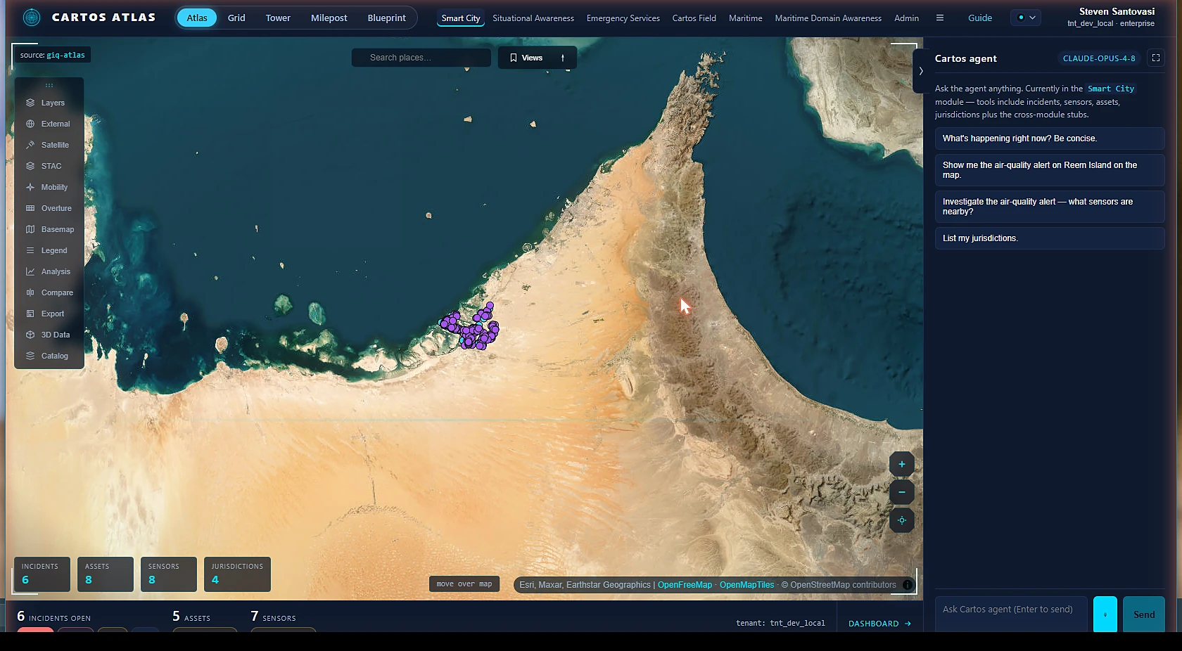
Cartos Atlas
Sample geography · Abu Dhabi & the Gulf
Cities, coasts & crisis on one screen — the founding government edition. Native 2D operations modules alongside a photoreal 3D common operating picture, with the AI analyst wired in from the first click.
LIVEReal OSM data — 95 hospitals + 201 schools (Smart City), 94 maritime features, 56 emergency assetsEnter Atlas →
Electric-utility edition
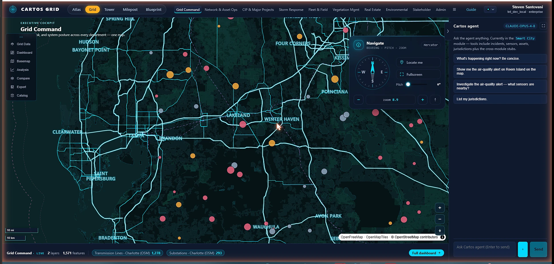
Cartos Grid
Sample geography · the Carolinas
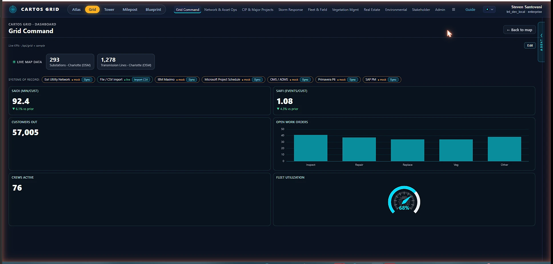
Nine utility departments over one operating picture, with live asset / outage / work-order data and KPI dashboards — and a real connector-adapter framework that wires each surface to the utility's own systems of record (Esri UN, OMS/ADMS, Maximo, SAP PM, P6, MS Project, file/CSV).
LIVE — RAiN PartnersReal OSM data — 293 substations + 1,278 transmission features; 3D substation columnsEnter Grid →
Airport edition
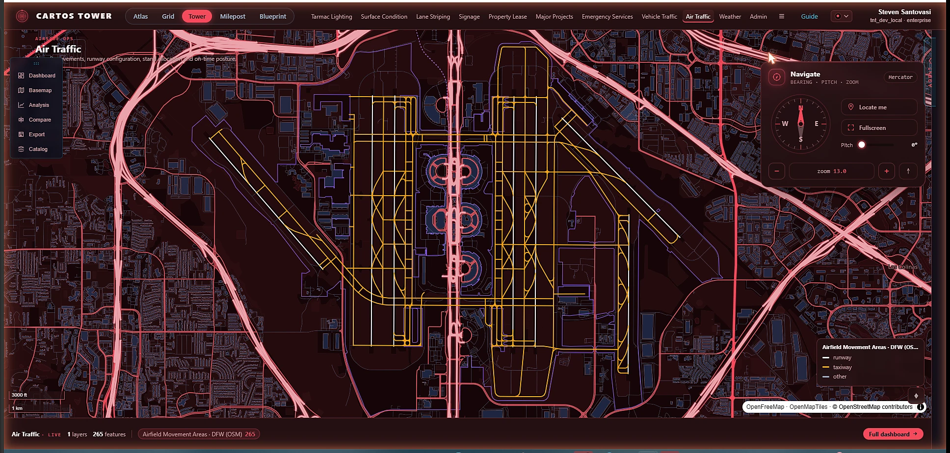
Cartos Tower
Sample geography · DFW
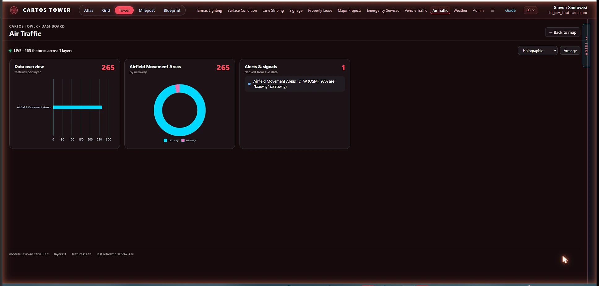
Airside to landside — every airfield asset on one operating picture. Ten operational departments an airport authority owns day-to-day, from ground lighting and pavement to air traffic and ARFF response.
Air TrafficSurface ConditionTarmac LightingLane StripingSignageProperty LeaseMajor ProjectsEmergency ServicesVehicle TrafficWeather
LIVEReal OSM data — 265 airfield features (DFW)Enter Tower →
Transportation / DOT edition
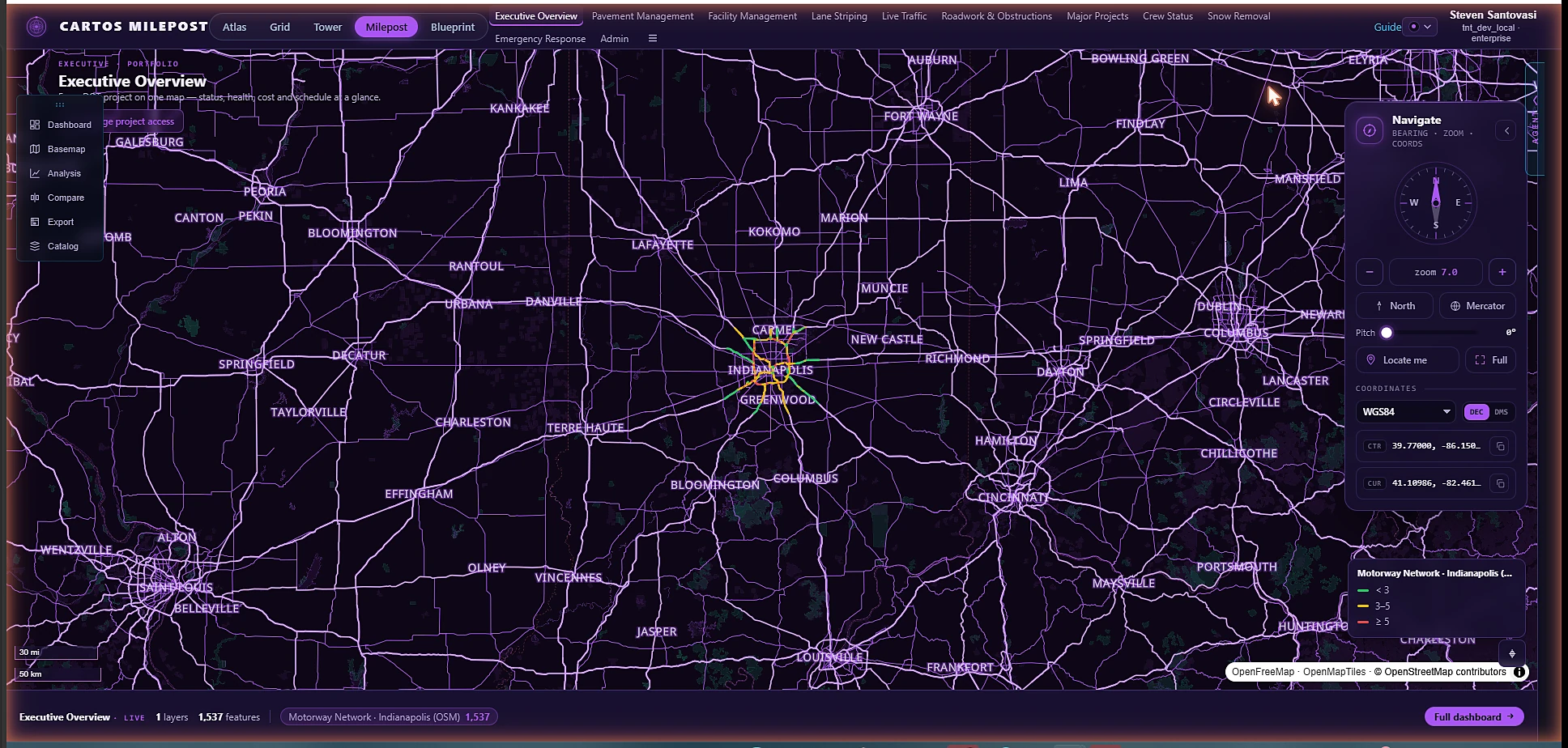
Cartos Milepost
Sample geography · Indiana
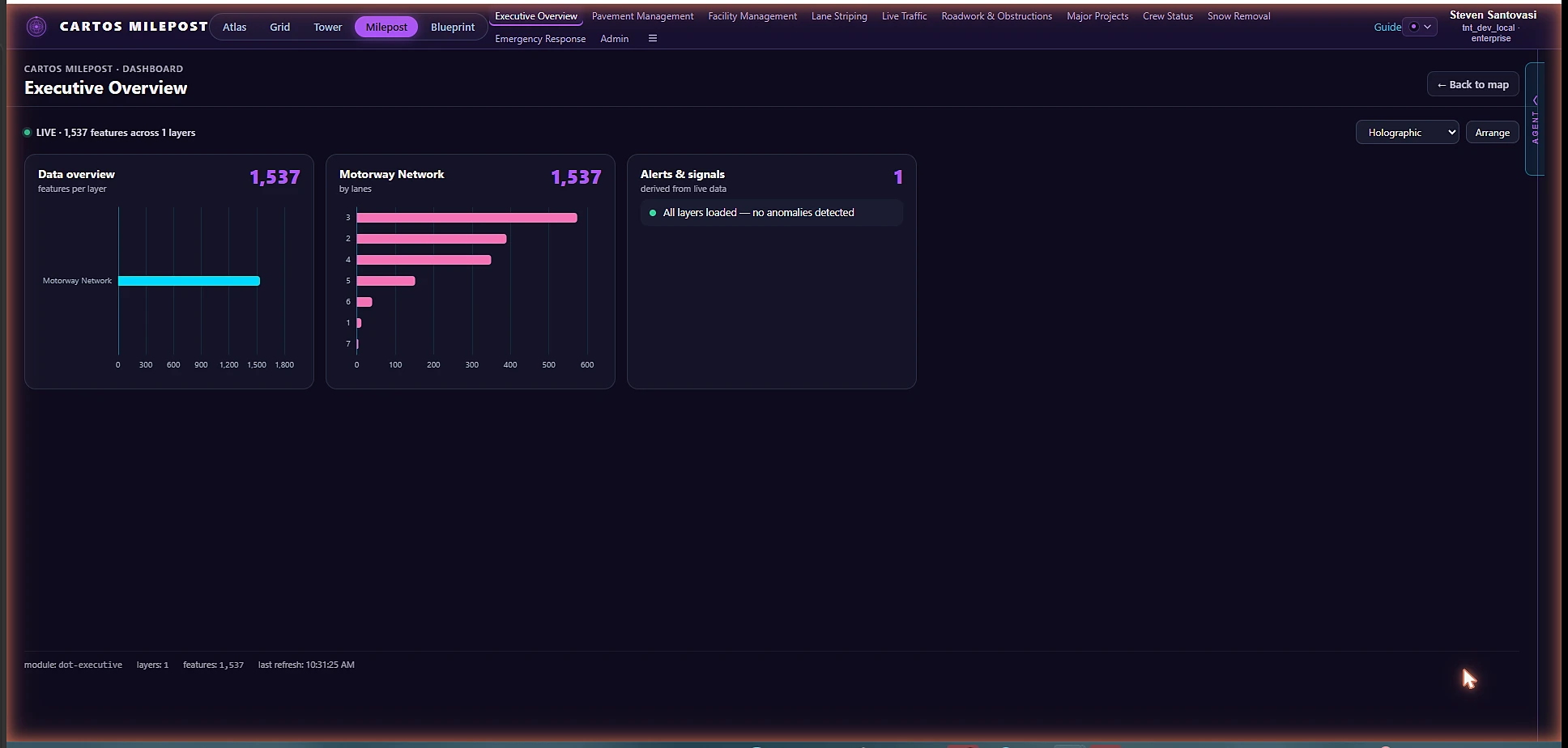
An executive overview of every DOT project, then drill to the work. A portfolio tab rolls up status, health, cost and schedule across all projects; project-level surfaces scope to a selected project with a HUD selector that recenters the map.
LIVEReal OSM data — 1,537 transportation features (Indianapolis)Enter Milepost →
Infrastructure-delivery / AEC edition
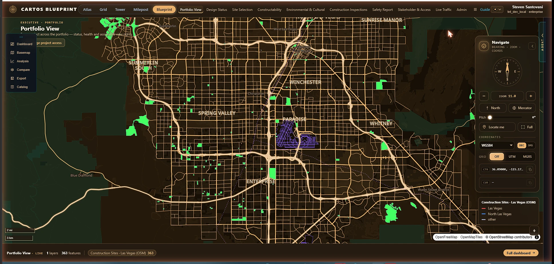
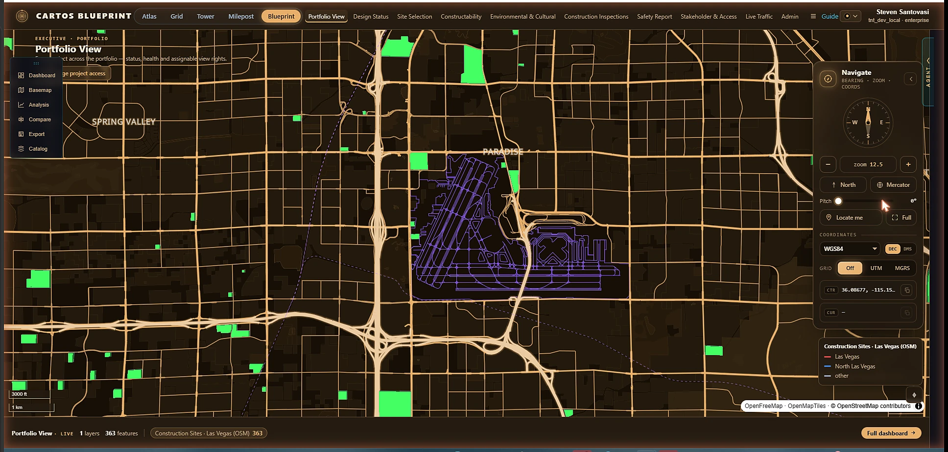
Cartos Blueprint
Sample geography · Las Vegas
A portfolio view across every capital project, then design, inspections, safety and approvals. Portfolio and per-project view rights are assignable to a department, agency, group, or individual user — the same access model, applied to delivery.
LIVEReal OSM data — 363 site features (Las Vegas); 3D extruded constructionEnter Blueprint →
Government edition · continental
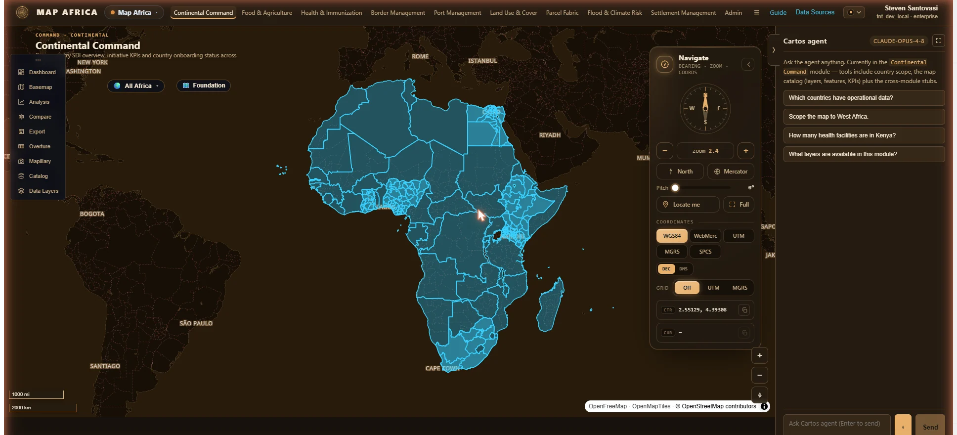
Cartos Africa
Sample geography · the African continent
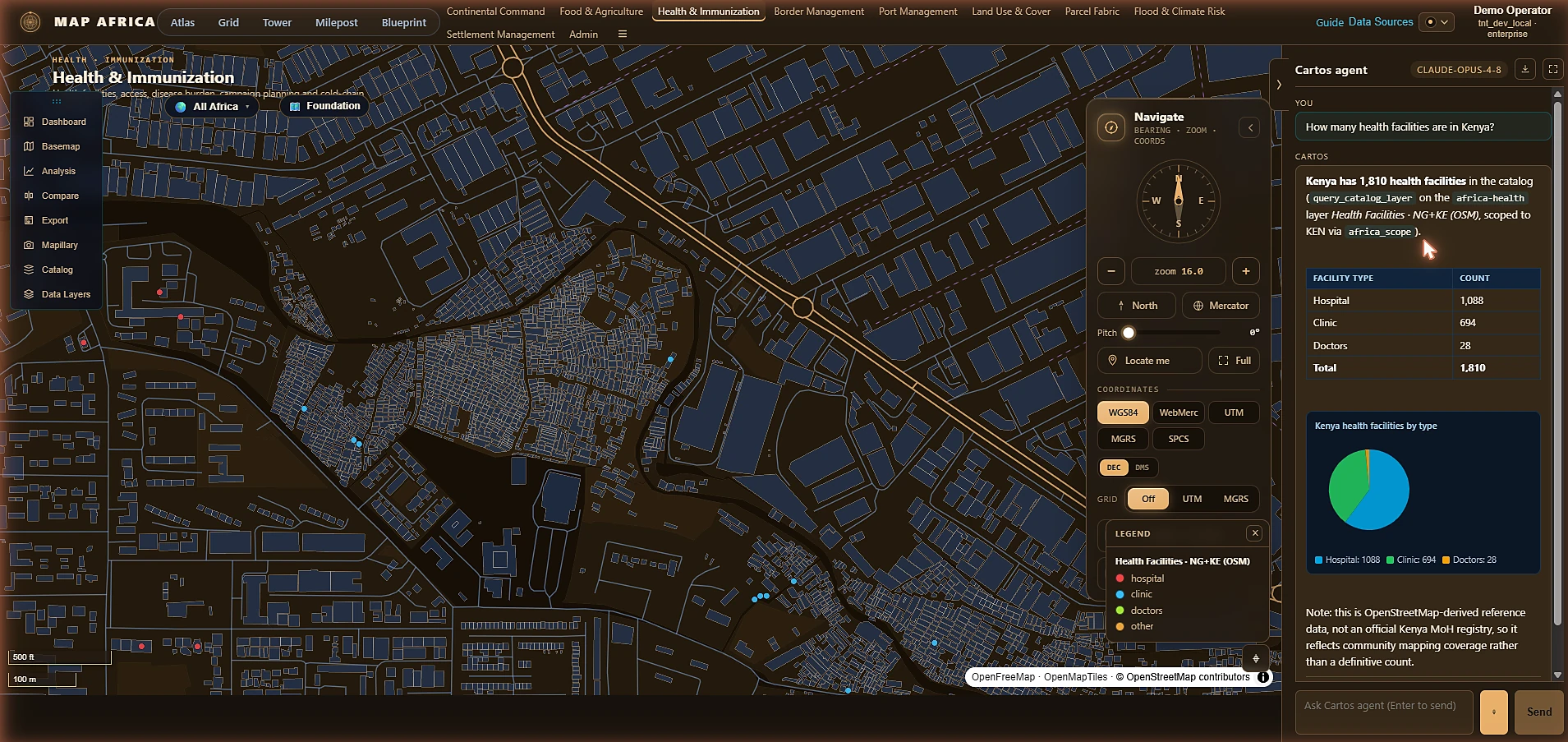
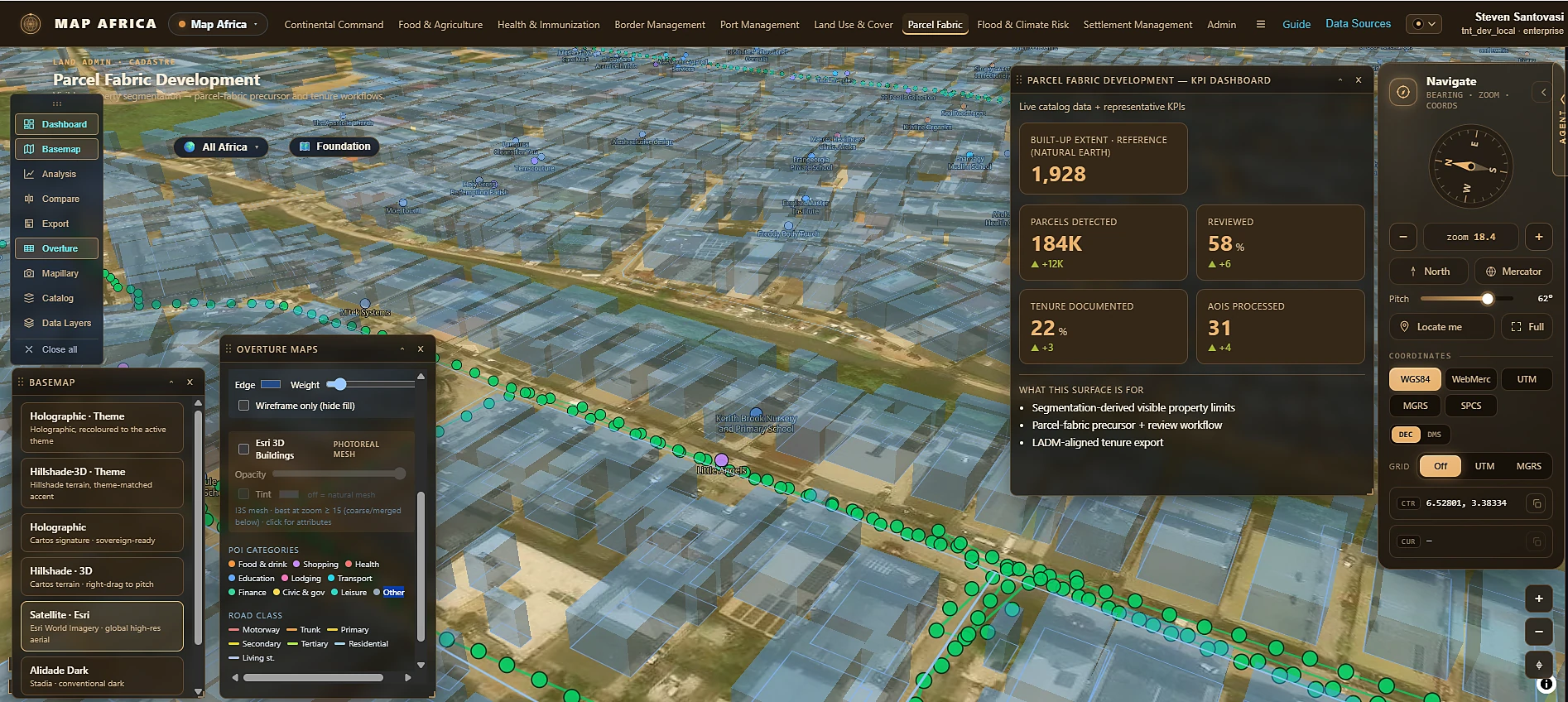
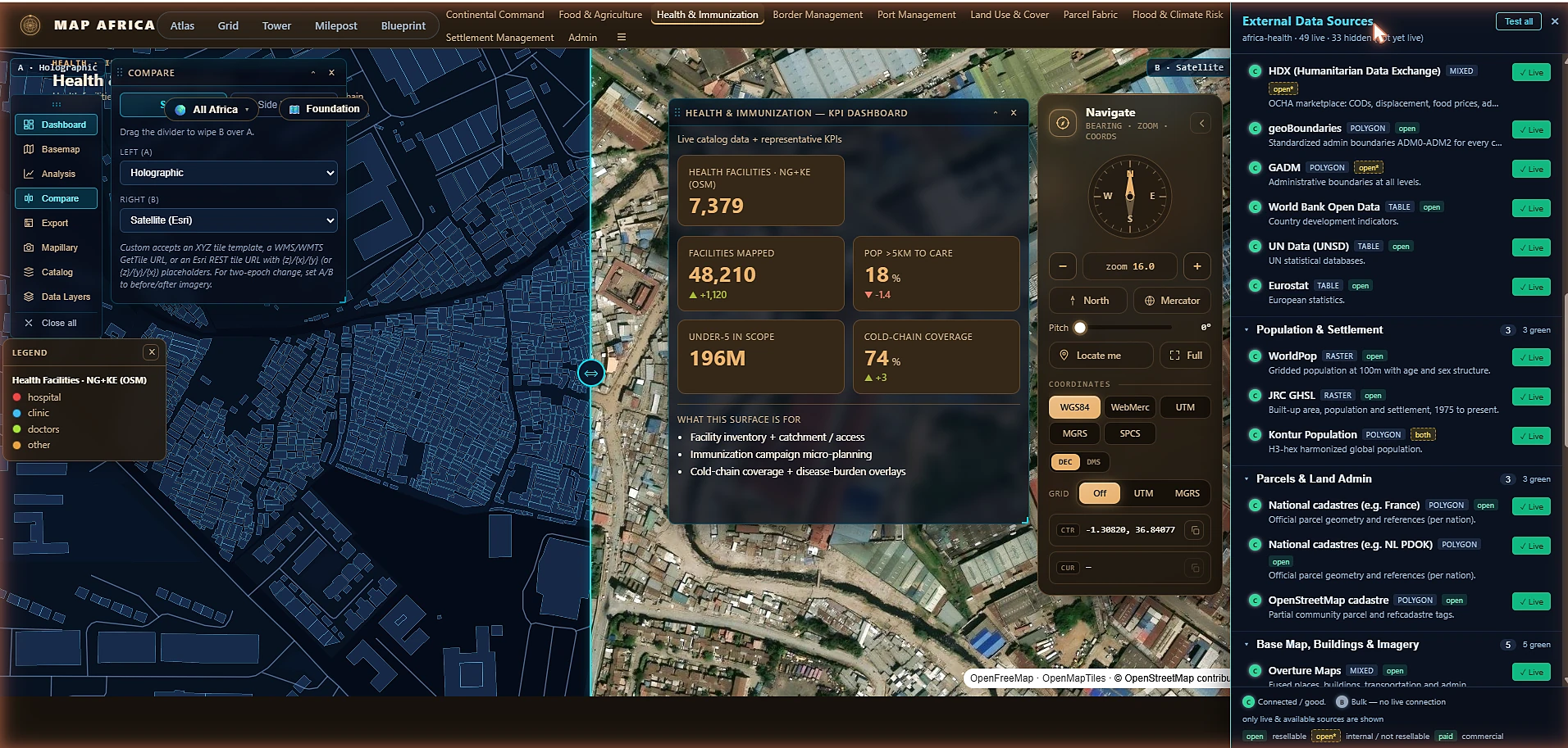
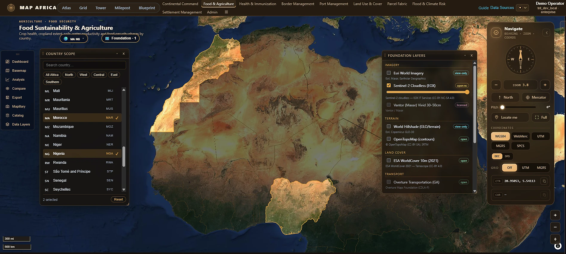
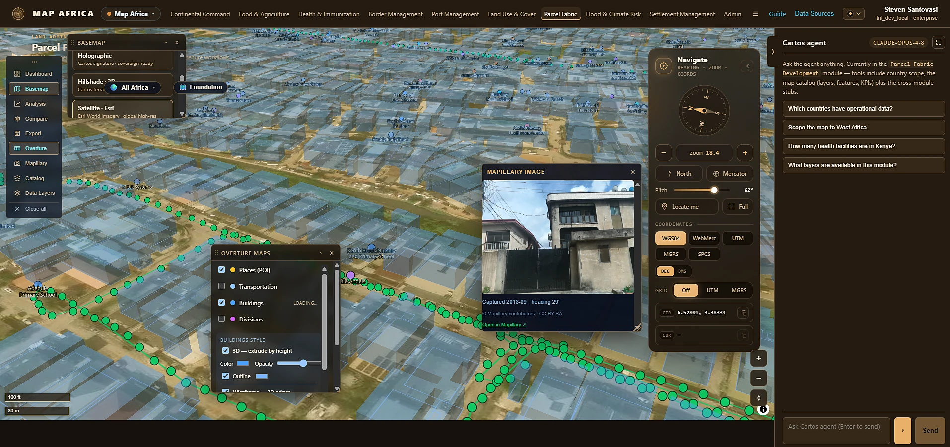
A standalone continental-scale Government edition for African governments, national mapping agencies and ministries — Cartos as the operational layer over open, free continental base-map data. Continental Command plus eight use-case departments (food security, health, borders, ports, land use, parcel fabric, flood & climate risk, settlements), a country-scope selector spanning all 54 African Union states with subnational drill-down, and a foundation-layer catalogue of open continental imagery, terrain and boundary data.
Continental Command — all 54 AU states, one scope selector.Ask the map — 1,810 Kenyan facilities counted, charted, and caveated by provenance.Parcel Fabric — a real LADM-aligned (ISO 19152) cadastral ingest now feeds it: Esri Parcel Fabric or any ArcGIS FeatureServer, same schema, human-reviewed, LADM tenure export.49 live external sources — each licence-gated, connection-tested, per module.Country scope — multi-select down to ADM1, filtering map, KPIs and the agent alike.Street-level truth — Mapillary + 3D Overture buildings on the same surface.
LIVEReal OSM + Natural Earth data across all 9 modules — 7,379 health facilities, 3,011 markets, 1,285 settlements, ports, protected areas and more, over 49 live external data sourcesEnter One Africa →
Government edition · critical-infrastructure protection
Cartos Guardian
Sample geography · the UAE & Strait of Hormuz
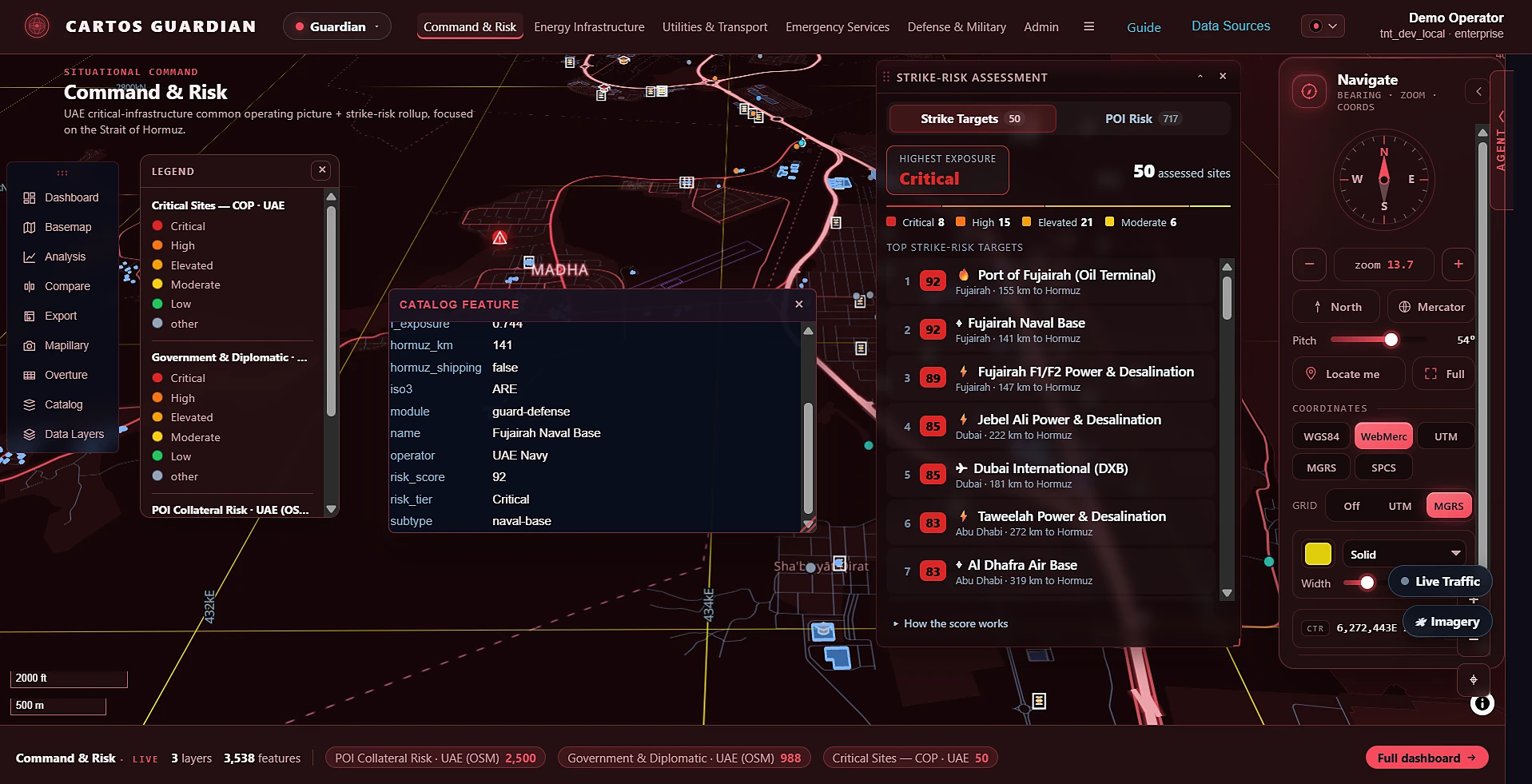
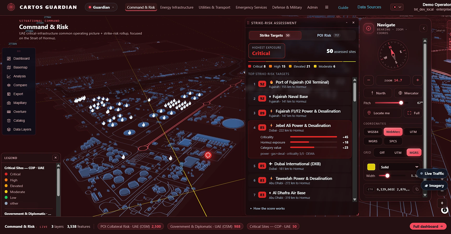
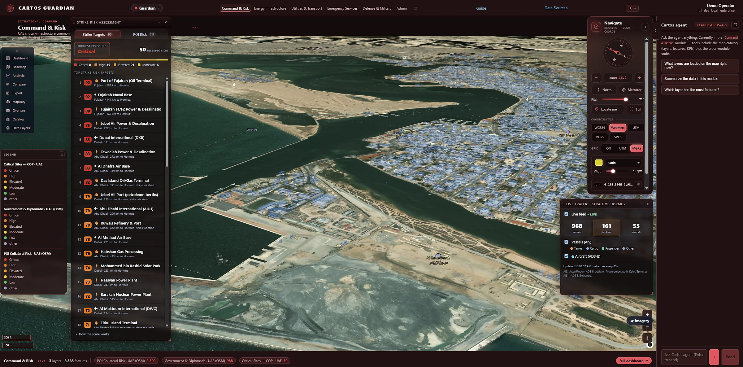
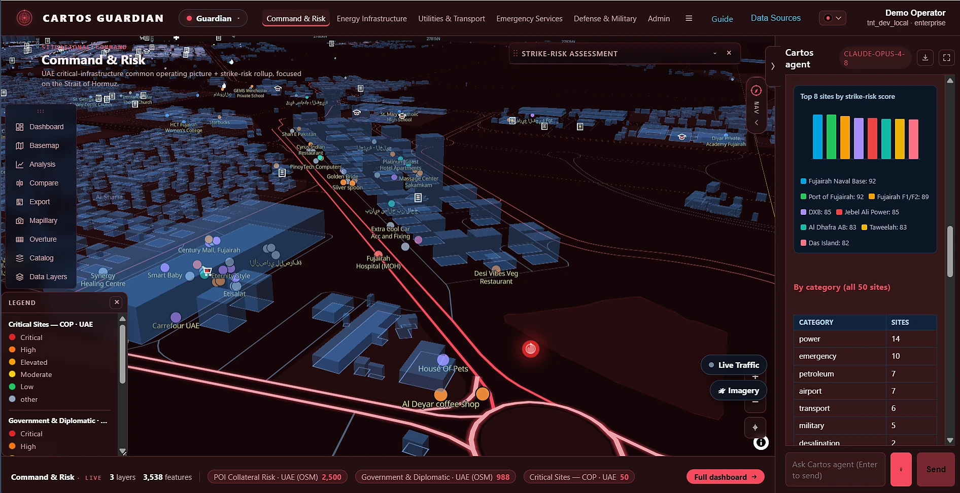
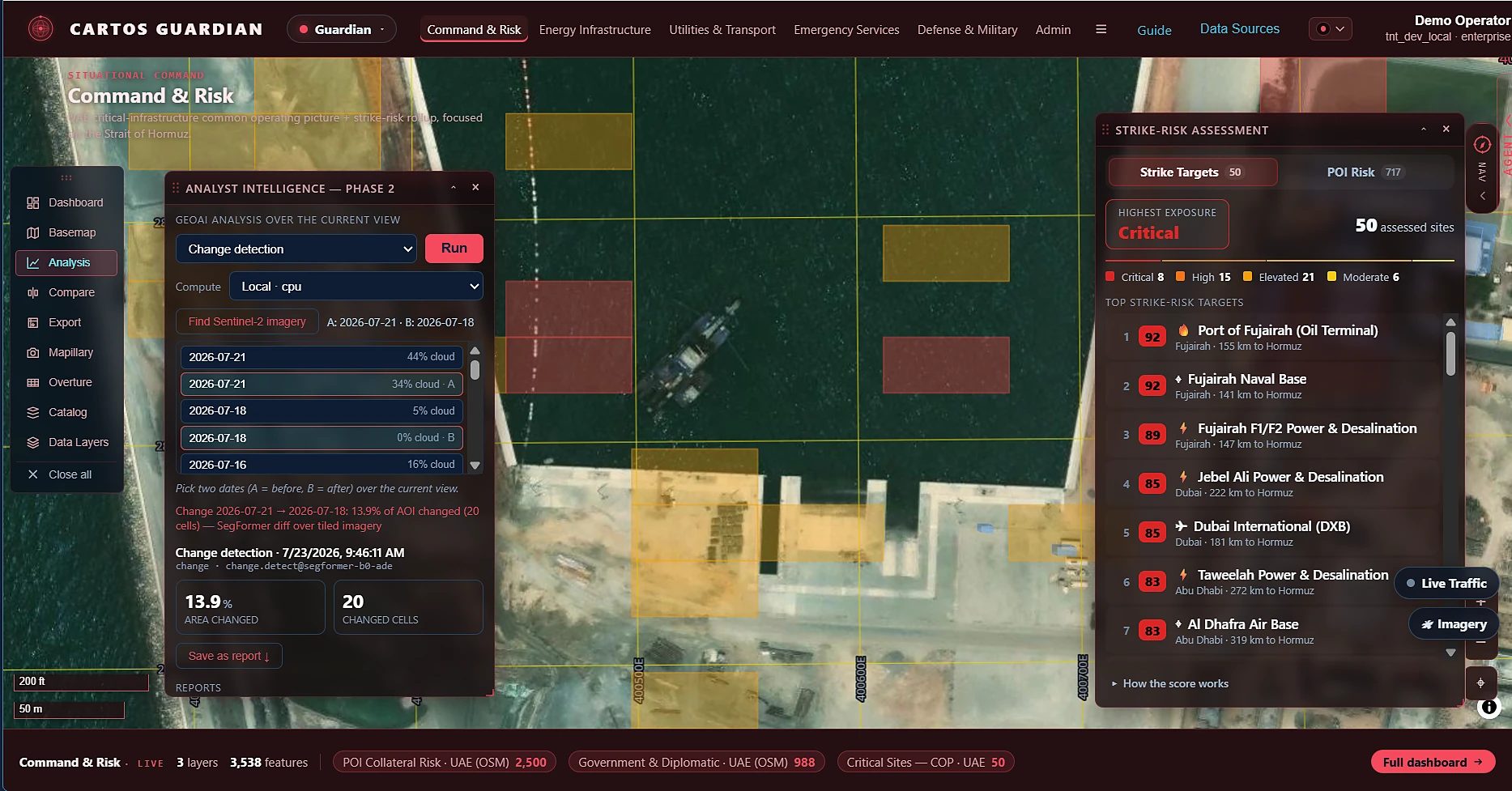
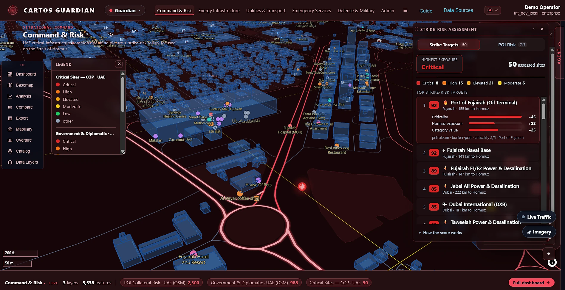
Proactive protection for civil infrastructure that could be a strike target. Five broad domains — command, energy, utilities, emergency services, and defense — over 103 curated UAE critical-infrastructure sites, each carrying a transparent, explainable 0–100 strike-risk score (criticality × Strait-of-Hormuz proximity × category weight). Grid-vulnerability, strategic-vector, and POI-collateral overlays, plus historical-imagery and live AIS/ADS-B traffic layers.
Command & Risk — 50 assessed sites ranked, 3,538 features live on one picture.Explainable score — criticality +45, Hormuz exposure +18, category +23. No black box.Live traffic — 968 vessels · 161 tankers · 55 aircraft, refreshed every 45s.Agent-native — the analysis is asked for, not authored.Analyst layer — 13.9% of AOI changed between epochs, savable as an auditable report.Collateral picture — critical sites, government & diplomatic, and 2,500 POI-risk features.
Command & RiskEnergy InfrastructureUtilities & TransportEmergency ServicesDefense & Military
LIVE103 curated UAE sites, 2,651 grid features, 2,500 POI-collateral features — ranked by a transparent strike-risk modelEnter Guardian →
Government edition · reactive crisis monitoring
Cartos Sentry
Sample geography · the UAE & Strait of Hormuz
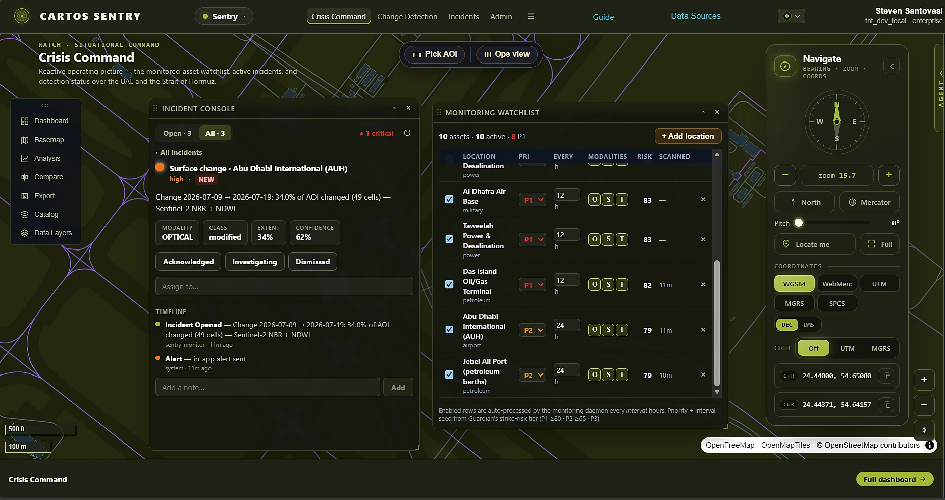
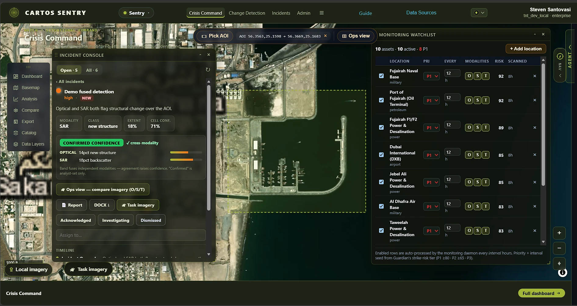
The reactive counterpart to Guardian: watch Guardian's highest-risk assets, autonomously detect a change, and open a scored incident with cross-modality evidence. An editable monitoring watchlist feeds the platform's first background ingestion daemon, which searches satellite catalogues, runs real optical/SAR/thermal change detectors, fuses a Low/Medium/High/Confirmed confidence band (never a fabricated percentage), and raises + dispatches an alert — all with a hard guard so a degraded model never fabricates an incident. From there: a side-by-side/swipe/change Ops View, per-building damage triage, an InSAR coherence context layer, one-click incident reports, and cost-visible commercial-tasking connectors (Umbra/Capella/ICEYE/Maxar/Planet) for the crisis-hour reactivity open imagery can't deliver.
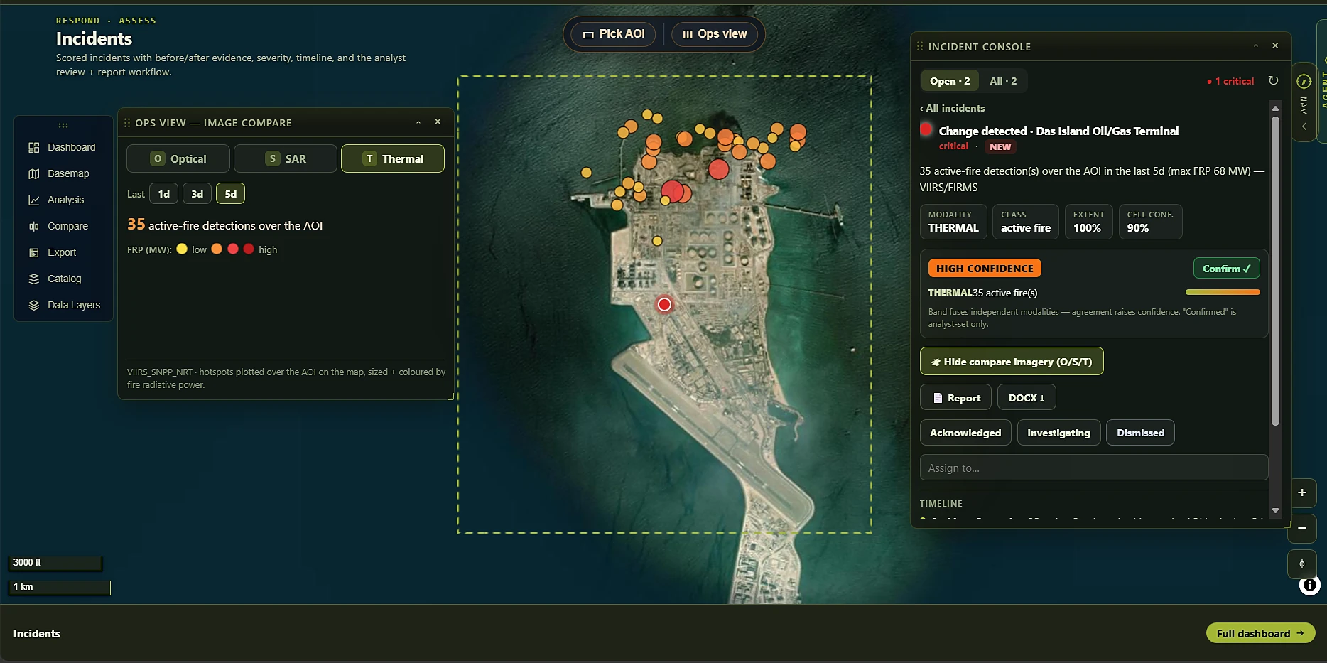
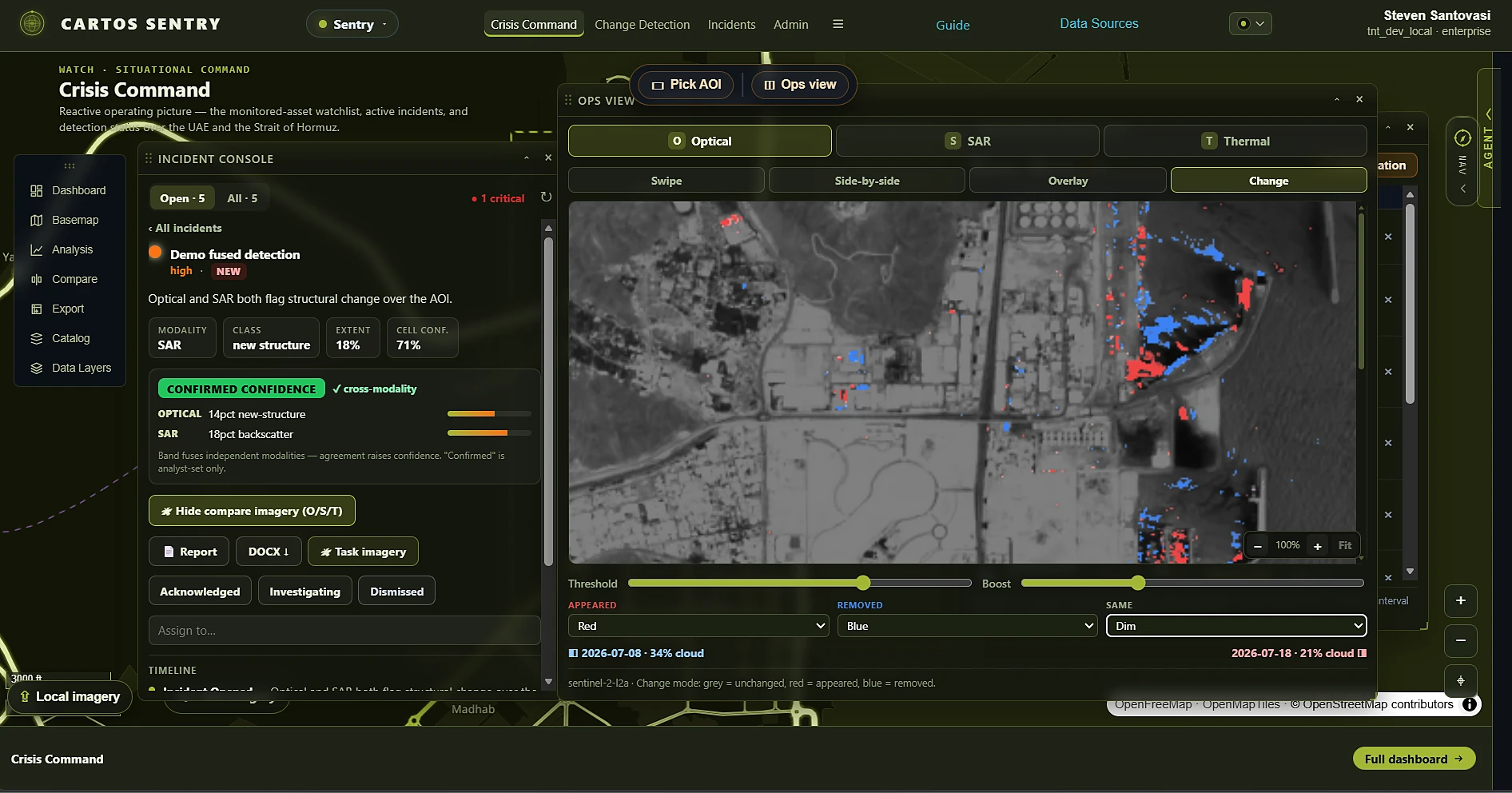
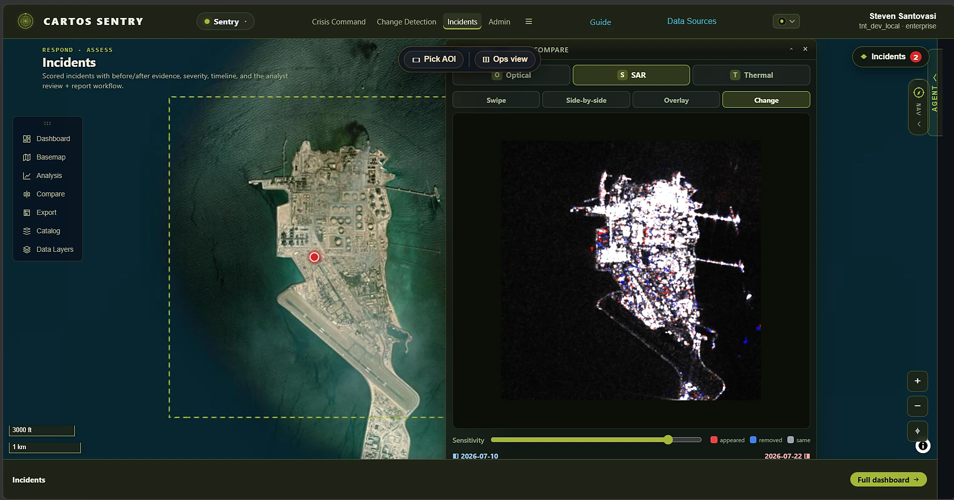
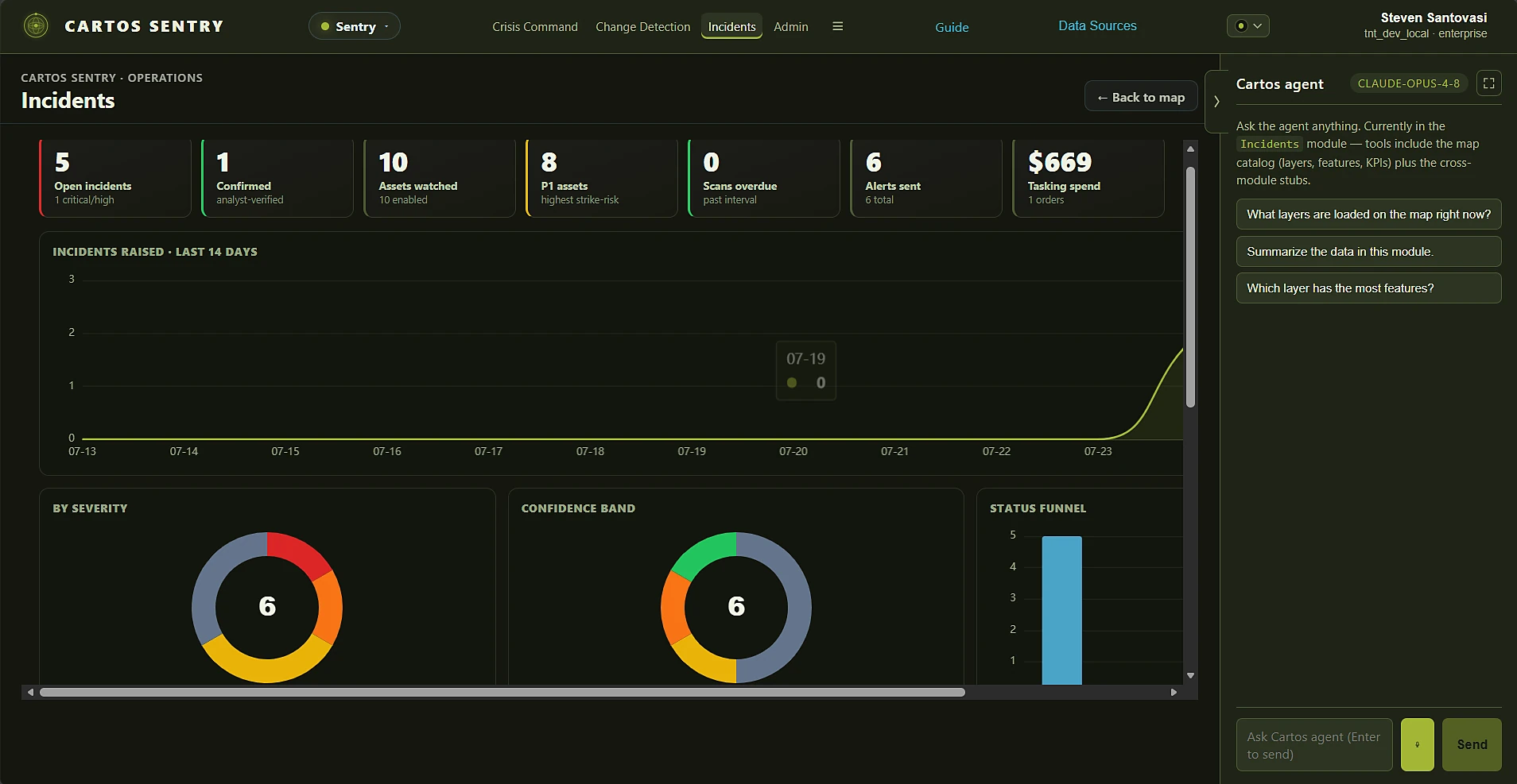
Crisis Command — 10 monitored assets, 8 at P1, scanned on an interval by the daemon.Cross-modality fusion — optical and SAR agreeing raises the band. Never a fake percentage.Thermal — 35 active-fire detections over Das Island, raised as a critical incident.Ops View — swipe, side-by-side, overlay and change, with analyst-tunable thresholds.SAR — cloud- and night-independent change, when optical can't answer.Cost-visible ops — 0 scans overdue, 6 alerts sent, $669 tasking spend, 1 order.
Crisis CommandChange DetectionIncidents
LIVEPlatform's first monitoring daemon + incident state machine + commercial-tasking connectors — real Sentinel-1/2 + FIRMS detectors, no fabricated confidenceEnter Sentry →
The pair: proactive risk, then reactive response.
Guardian and Sentry are not two products that happen to sit next to each other. Guardian's per-site strike-risk score is Sentry's watchlist priority — and that priority sets the scan interval, which sets the alert threshold, which sets how much commercial tasking spend a crisis-hour incident can defensibly justify. One number carries all the way from risk model to procurement decision.
01 · GUARDIAN
Score the estate
103 curated sites scored 0–100 from criticality, Hormuz exposure and category weight — every component visible.
02 · HANDOFF
Seed the watchlist
Tier drops straight into Sentry: P1 ≥ 80, P2 ≥ 65, P3 below. Priority sets the scan interval — 12h for P1, 24h for P2.
03 · SENTRY
Detect and fuse
A background daemon searches the catalogues and runs real optical, SAR and thermal detectors. Independent agreement raises the confidence band.
04 · RESPOND
Task and report
Open a scored incident, dispatch the alert, export the DOCX, and — when open imagery can't answer in the hour — task Umbra, Capella, ICEYE, Maxar or Planet with the cost on screen.
Agriculture-intelligence edition
Cartos Harvest
Sample geography · Kenya & Nigeria
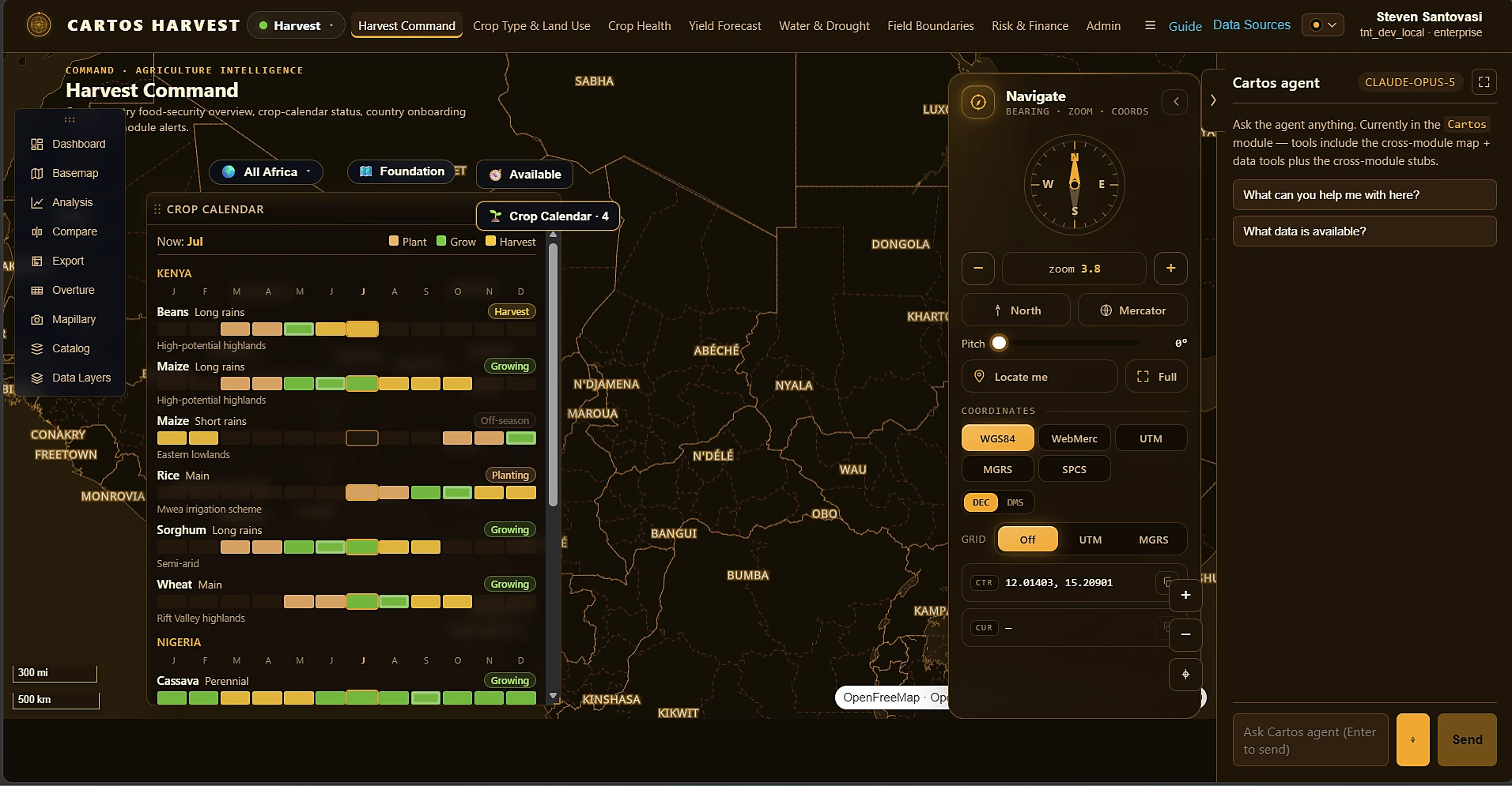
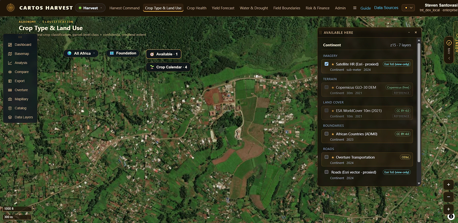
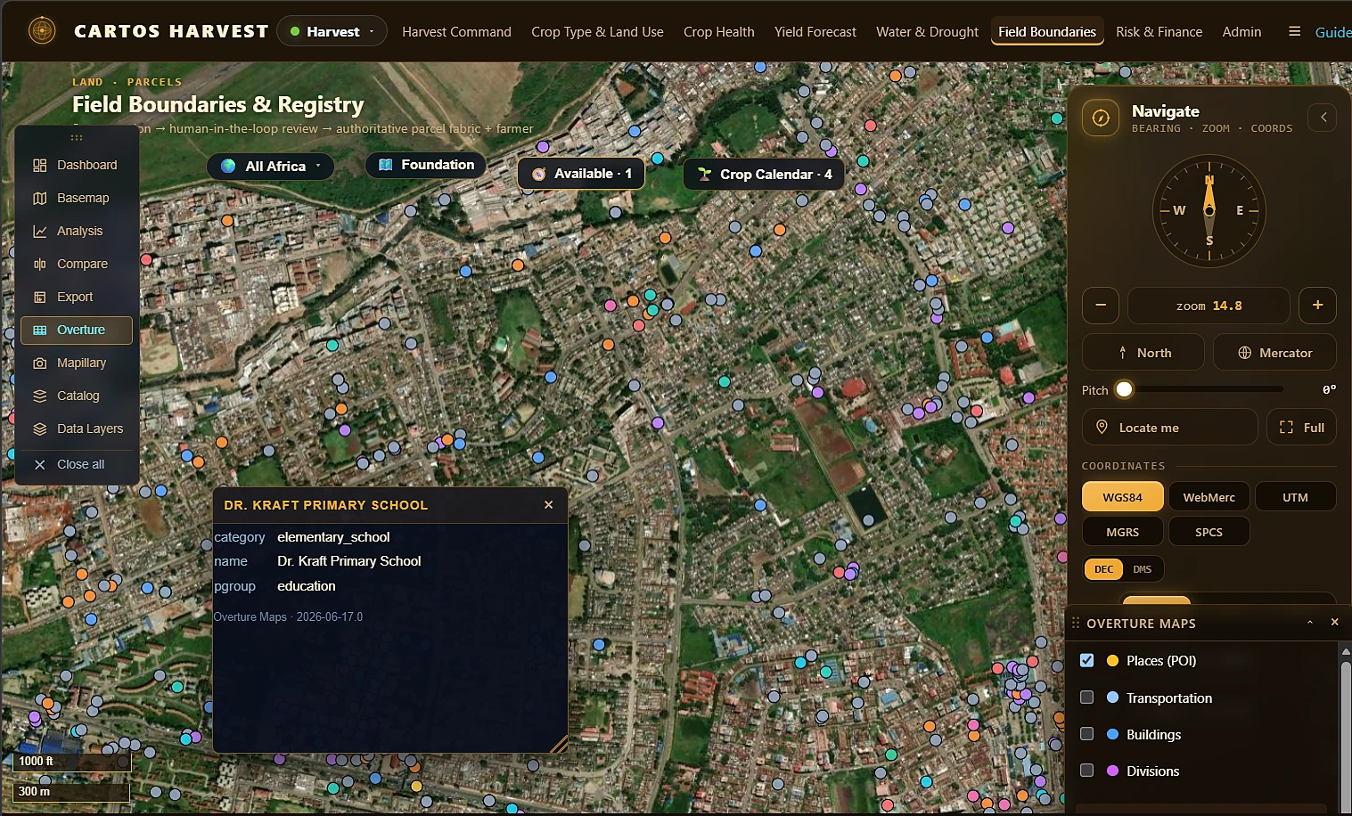
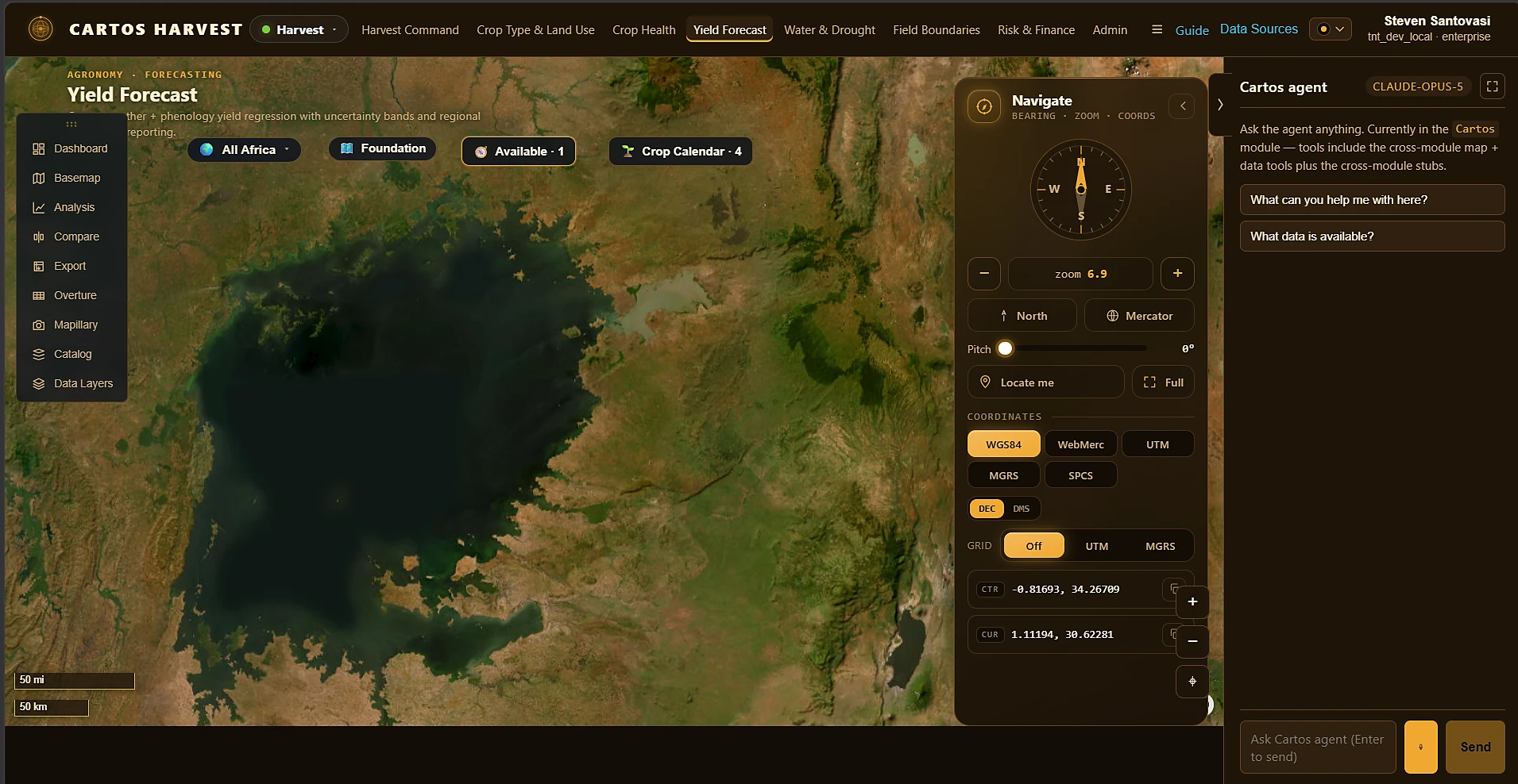
STAC-native crop intelligence for ministries of agriculture, agri-insurers/lenders, and extension services: seasonal-phenology crop-type classification, NDVI-anomaly crop health, a season-NDVI yield proxy with an honest inter-annual uncertainty band, water-stress/drought detection, field-boundary delineation with human-in-the-loop review, and a transparent 0–100 agri-risk score with an index-insurance trigger — all resolved live from Sentinel-2 via Microsoft Planetary Computer. Reuses Cartos Africa's country-scope and foundation-layer fabric rather than rebuilding it.
Harvest Command — crop calendars by country, season and agro-zone; plant / grow / harvest status live for the current month.Crop Type & Land Use — parcel-level class + confidence, over the best imagery available here.Field Boundaries & Registry — segmentation → human-in-the-loop review → authoritative parcel fabric + farmer registry.Yield Forecast — a season-NDVI yield proxy with an honest inter-annual uncertainty band, not a single confident number.
Harvest CommandCrop Type & Land UseCrop HealthYield ForecastWater & DroughtField Boundaries & RegistryRisk & Finance
LIVESeven surfaces resolved live from Sentinel-2 via Microsoft Planetary Computer — reusing Cartos Africa’s country-scope and foundation-layer fabricEnter Harvest →
Per-project access control (Milepost & Blueprint): project-scoped surfaces enforce per-project and portfolio-wide grants — default-deny, assignable to a department, agency, team, or user — so a portfolio can be shared exactly as far as the org chart allows.
Cartos Africa is live at africa.cartosatlas.com — a standalone continental Government edition for African governments and national mapping agencies, with real data across all nine modules and subnational country scope over the 54 African Union states.
Cartos Guardian (guardian.cartosatlas.com) and Cartos Sentry (sentry.cartosatlas.com) are a deliberate pair — Guardian's per-site strike-risk score seeds Sentry's monitoring-watchlist priority, which in turn sizes the commercial-tasking spend a crisis-hour incident can defensibly justify.
Cartos Harvest is live at harvest.cartosatlas.com — the ninth edition, and the fastest to ship, because it inherited Cartos Africa's country-scope and foundation-layer fabric rather than rebuilding it.
Every edition inherits it
Built once in the engine, reused in every edition.
The differences between editions are the modules and the theme. Everything below is the shared engine — so every vertical, present and future, gets it for free.
Operational data
Real data, per module
An admin-managed datasource + layer catalogue seeds real operational data into every module — thousands of live features across all eight editions — scoped by tenant, edition, module, group, role, and user type.
Cartography
Full symbology engine
Attribute-driven styling — categorical and graduated colour and size, legends, and real 3D: polygon fill-extrusions and deck.gl 3D point columns, configured per layer in-app.
Dashboards
KPI dashboards
Every module carries a configurable KPI dashboard bound to live catalog data — compose the cards, read the health at a glance, and drill from a KPI straight to the place on the map.
Agent
Ask the map
One AI agent reasons across every accessible datasource in every edition — discover layers, filter by attribute, find what's within a distance, group and count — always inside the asking user's access scope.
Cartos Field stands up no-code, offline-first mobile apps whose captures surface back inside these modules and are queryable by the agent — the ground-truth edge for every edition. See it →
Admin & theming
Configured per client
A three-tier Keycloak-backed admin model turns modules and features on per deployment; a platform theme system re-skins the whole surface — one palette or a per-module override, with the map recolouring to match.
License an edition
Your industry, on a sovereign engine.
Nine editions ship today, and the next vertical is a catalogue away — Harvest went from prompt package to a merged, running agriculture-intelligence edition in weeks, reusing Africa's country-scope and foundation-layer fabric rather than rebuilding it. Bring a real operational workflow and a sovereignty constraint; we'll stand it up as its own instance under NDA. Design-partner cohorts are deliberately small.