
Cartos Atlas5
Government
Smart City · Maritime · Emergency Services · Situational Awareness (3D) · Maritime Domain Awareness (3D)
Cartos · The Approach
The geospatial market makes you pick one. A general-purpose GIS suite you must staff an entire department to operate. A point solution that answers one question and dead-ends. A consultancy build that is perfect on delivery day and orphaned by the next budget cycle. Cartos refuses the trade. One sovereign engine that is agent-native at the interface, enterprise-grade underneath, built for the way public agencies are actually held accountable — and delivered as purpose-built, solution-specific editions. One platform. Nine industries. 67 department modules. All nine editions are live, and four of them shipped in the last six weeks.
The scale of it
Not eight products with a shared logo — one engine, one data fabric, one agent, one admin model, one login. Every number below is counted from the engine's own module registry, not from a slide.
Smart City · Maritime · Emergency Services · Situational Awareness (3D) · Maritime Domain Awareness (3D)
Grid Command · Network & Asset Ops · CIP & Major Projects · Storm Response · Fleet & Field · Vegetation · Real Estate · Environmental · Stakeholder
Air Traffic · Surface Condition · Tarmac Lighting · Lane Striping · Signage · Property Lease · Major Projects · Emergency Services · Vehicle Traffic · Weather
Executive Overview · Pavement · Facility · Lane Striping · Live Traffic · Roadwork · Major Projects · Crew Status · Snow Removal · Emergency Response
Portfolio View · Design Status · Site Selection · Constructability · Environmental & Cultural · Inspections · Safety · Stakeholder & Access · Live Traffic
Continental Command · Food & Agriculture · Health & Immunization · Border · Port · Land Use & Cover · Parcel Fabric · Flood & Climate Risk · Settlement
Command & Risk · Energy Infrastructure · Utilities & Transport · Emergency Services · Defense & Military
Crisis Command · Change Detection · Incidents
Harvest Command · Crop Type & Land Use · Crop Health · Yield Forecast · Water & Drought · Field Boundaries & Registry · Risk & Finance
Sixty-seven modules is what a decade of separate procurements normally buys you — from nine vendors, on nine logins, over nine copies of your data. Here it is one deployment, one permission model, and one agent that can reason across all of it.
It reads what you already own
A geospatial agent that can only see its own database is a demo. Cartos was built to connect outward — into the enterprise systems that hold the authoritative record, into the open standards every mapping agency already publishes, and into the imagery supply chain from free archives up to same-day commercial tasking. Everything below is shipped and wired, not a roadmap.
Connector-adapter framework with per-tenant registration, scheduled sync and connection status.
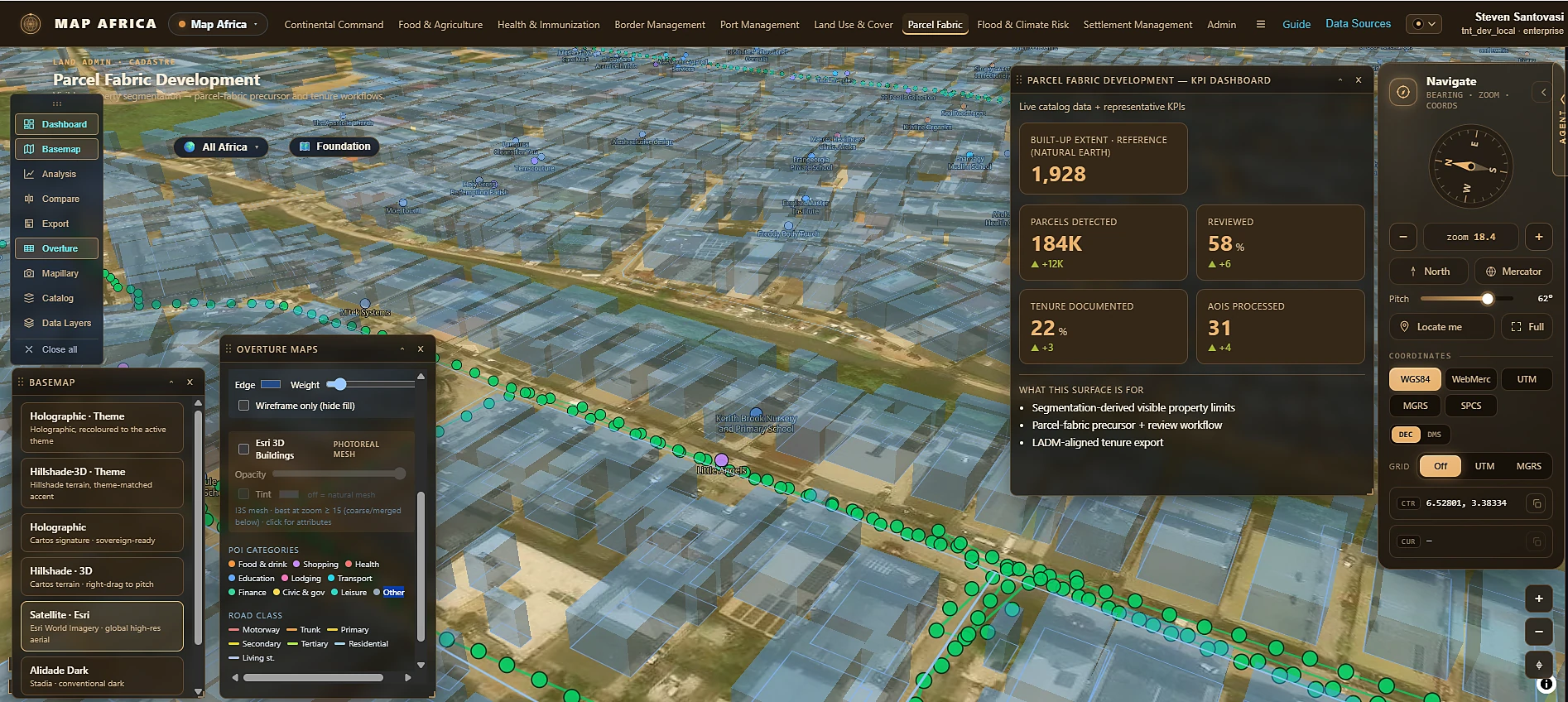
esri_unEsri Utility Network — asset and network features synced into the operating picture.parcel_fabricEsri Parcel Fabric — the documented Parcel Fabric information model mapped into a source-agnostic, LADM-aligned (ISO 19152) cadastral store: spatial units, basic administrative units, rights/restrictions/responsibilities and parties. Human review survives re-sync.featureserverGeneric ArcGIS parcel service — a config-driven field map lands any cadastre FeatureServer in the same schema, so you can move between sources without a migration.oms_admsOMS / ADMS — live outage and switching state feeding outage KPIs and the storm map.maximoIBM Maximo — work orders synced with source-prefixed external references.sapSAP PM — plant-maintenance work orders on the same normalised model.p6Oracle Primavera P6 — capital projects, schedule, cost and status.msprojectMicrosoft Project — the same project fabric from an MS schedule.file_csvFile / CSV import — for the systems that will never have an API.One row per connector per tenant, validated at the database, with a connected / configured / error state visible to the admin.
Datasource types in the managed catalogue — added in-app, scoped by tenant, edition, module, group, role and user type.
arcgis-restEsri Feature & Map Services — ArcGIS REST endpoints, including secured ones, server-proxied.wmsOGC WMS — capabilities-probed and rendered as a styled layer.wmtsOGC WMTS — tiled map services, the mapping-agency default.xyz-rasterXYZ raster tiles — any slippy-tile template, including your own.geojson-urlGeoJSON endpoints — the universal exchange format.pmtilesPMTiles — range-read vector tiles direct from object storage.cogCloud-Optimized GeoTIFF — imagery and elevation read in place.flatgeobufFlatGeobuf — streaming vector at scale.postgisClient-hosted PostGIS — your own database, in your own territory.Plus STAC catalogues, NASA GIBS, and Overture Maps places, transportation, buildings and divisions as first-class overlay kinds.
From free archive to same-day tasking, with the licence posture and the price on screen before you commit.
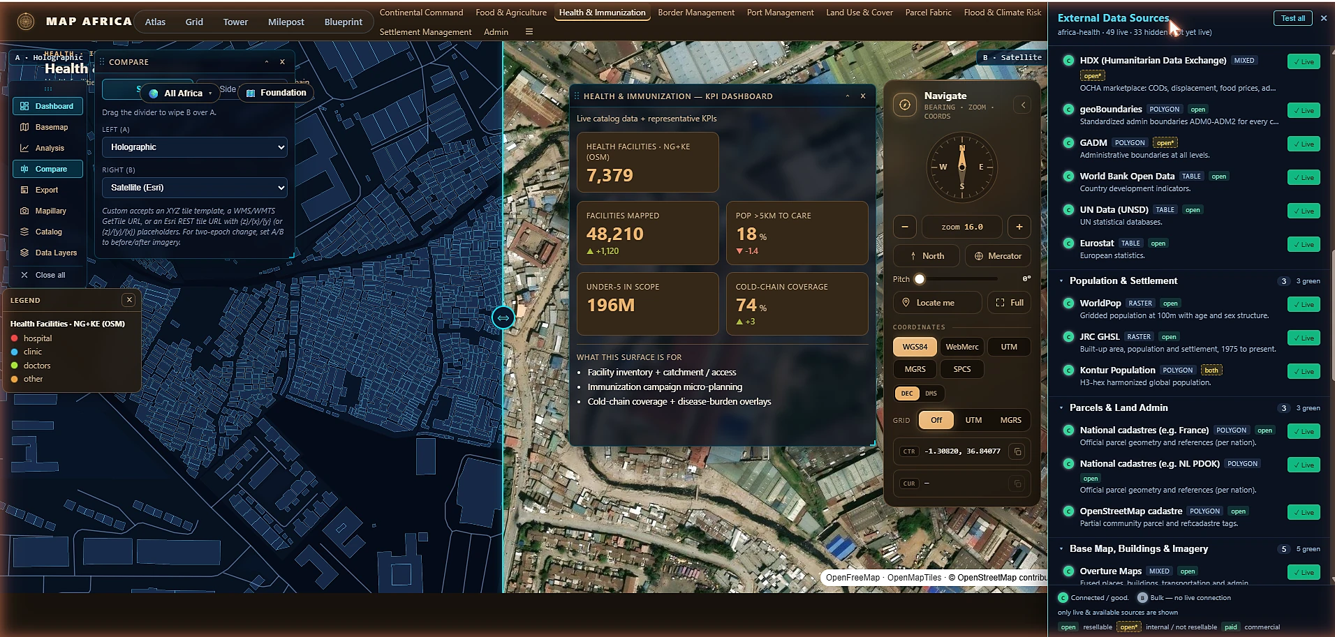
sentinelSentinel-1 SAR & Sentinel-2 optical — resolved live via Microsoft Planetary Computer STAC.landsatLandsat C2 L2 — including thermal bands for the heat and fire detectors.firmsVIIRS / FIRMS — active-fire detections with fire radiative power.umbraUmbra — SAR tasking to 0.25 m.capellaCapella Space — SAR tasking to 0.5 m.iceyeICEYE — SAR tasking to 0.25 m.maxarMaxar — optical tasking to 0.3 m.planetPlanet — optical tasking to 0.5 m.Plus local and GeoTIFF upload for imagery you already hold, and an 82-source external registry — 49 live — spanning HDX, geoBoundaries, GADM, World Bank, UN Data, WorldPop, JRC GHSL, Kontur and national cadastres.
This is the part that makes the agent useful rather than impressive. When an analyst asks Cartos a question, the answer can draw on your Esri feature services, your Maximo work orders, your P6 schedule, your own PostGIS, the open continental base map, and this morning's Sentinel pass — inside one permission scope, with the sources named in the reply. Nobody has to export anything to a shapefile first.
The model
Each of these is hard on its own. The reason they rarely coexist is architectural: bolting an agent onto a legacy suite doesn't make it agentic, and hand-building one agency's solution doesn't make it enterprise. Cartos was built the other way round — the hard parts once, in the engine, so every vertical inherits all four for free.
One AI analyst reasons across every datasource the asking user can see — discovers layers, filters, measures proximity, groups and counts, and says so when the data can't support the answer.
Tenant- and team-isolated data fabric, three-tier Keycloak admin, per-module and per-project access grants, a managed layer catalogue, and connectors into the systems of record you already run.
Sovereign in-territory by default, licence posture enforced in code, scores decomposed into their components, confidence never fabricated, and every spend visible before it's committed.
A vertical is a curated catalogue of department modules with its own theme, geography and data — running on the same engine. New editions ship in weeks, and every one of them upgrades all the others.
Almost every GIS vendor now ships "AI." Nearly all of it is a chat box stapled to the side of a product that still requires you to know which layer to open, which field to query, and which projection to fight. Cartos is agent-native: the agent holds the same catalogue, the same scope, and the same access rules the map does, so asking it something is genuinely equivalent to doing it yourself — and materially faster.
catalog_layers, query_catalog_layer, scope filters — operating on the live catalogue, not a summary of it.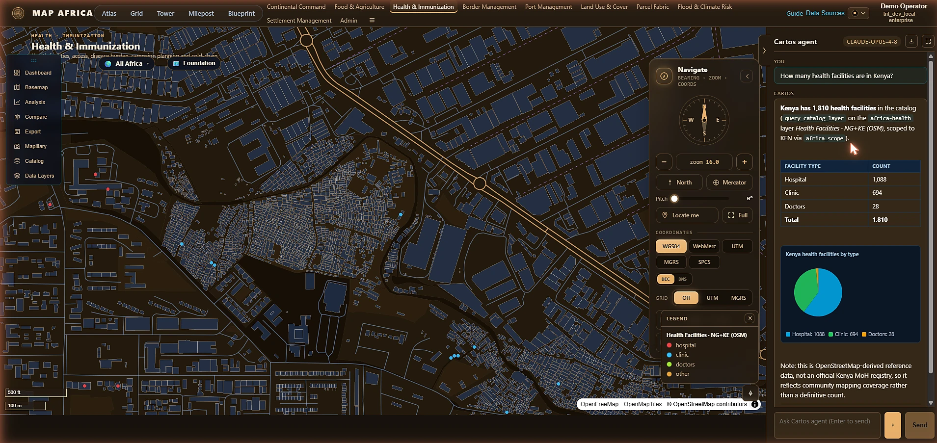
Enterprise isn't a logo on a pricing page — it's what happens on day 400, when the person who built the maps has moved on, four departments need different slices of the same truth, and procurement wants to know exactly who can see what. Cartos puts that model in the engine: a managed catalogue, a real permission tree, and adapters into the systems of record that already hold the authoritative data.
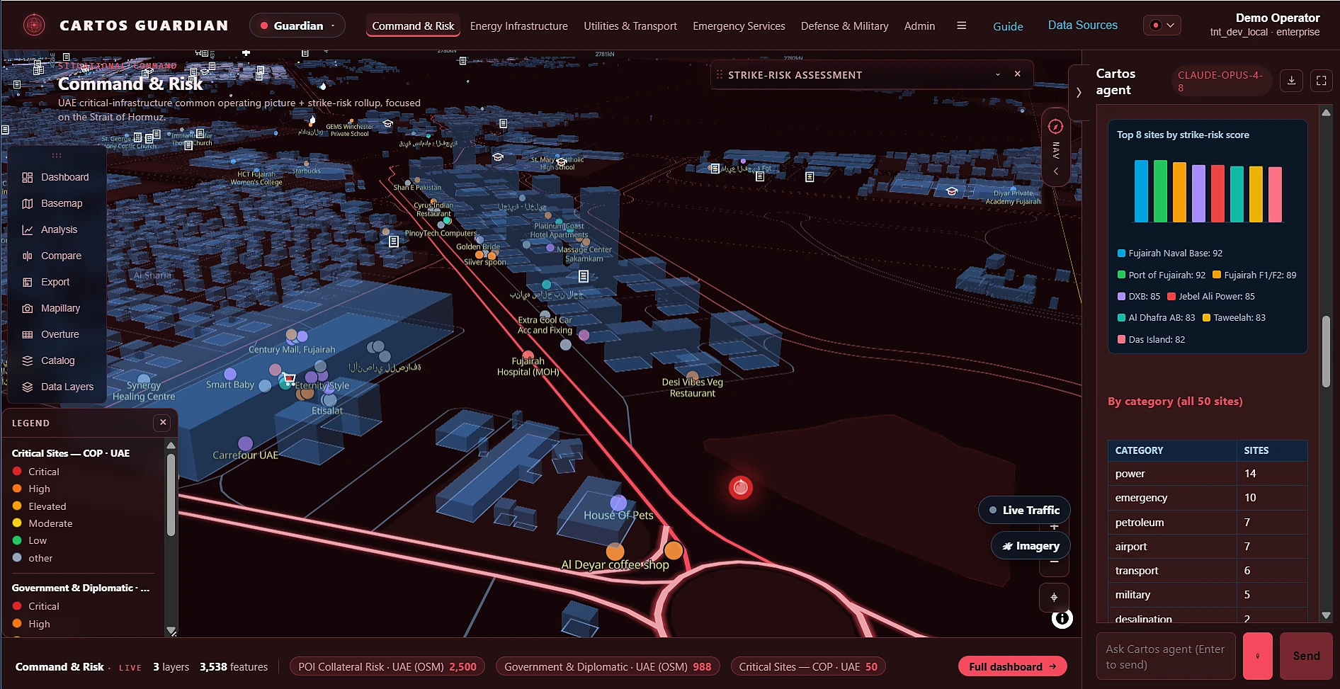
Commercial software can afford to be confidently wrong. A ministry, a defence command or a national mapping agency cannot. Agency-grade means the output has to withstand a hostile question from an auditor, a minister, or opposing counsel — so the system is built to show its work, refuse to invent certainty, keep the data inside the territory, and put a price on the screen before anyone commits to it.
This is the part that is genuinely hard to copy. A general platform can be configured into anything and is therefore good at nothing on day one. A bespoke build is excellent on day one and never improves. Cartos editions are curated slices of one engine: each ships with its own modules, theme, geography and seeded operational data — and every engine-level improvement lands in all nine at once.
The trade nobody else refuses
Shown as categories of approach rather than named vendors — the constraint is architectural, and it applies to whoever is currently occupying each category.
| Approach | Agentic | Enterprise | Agency | Solution-specific | Where it breaks |
|---|---|---|---|---|---|
| General-purpose GIS suite The incumbent desktop-and-server stack |
Bolted on | ✓ | Partial | ✗ | Powerful and generic. Becomes a solution only after a long integration programme, and needs a standing GIS department to stay useful. |
| Point solution One question, answered well |
Sometimes | ✗ | Partial | ✓ | Excellent at its one job. The second question needs a second vendor, a second contract and a second copy of your data. |
| Consultancy build Bespoke, delivered to spec |
✗ | Partial | ✓ | ✓ | Fits perfectly on delivery day. Improves only when funded again, and never benefits from anything built for anyone else. |
| Imagery / analytics API Pixels and detections as a service |
API-level | Partial | ✗ | ✗ | Sells inputs, not decisions. Someone still has to build the operating picture, the workflow and the accountability around it. |
| Cartos Engine → editions → sovereign instances |
✓ | ✓ | ✓ | ✓ | The hard parts are built once in the engine, so a new vertical is a catalogue and a theme — and every edition inherits every improvement. |
The honest version of this table: any one row can be beaten on its own axis by a specialist. What none of them can do is hold all four at once — because holding all four requires having built the engine before you built the solutions, and that decision can only be made at the start.
The receipts
The clearest evidence that the model works isn't an architecture diagram — it's the delivery rate. These four shipped consecutively, each reusing the last, all in mid-2026.
A continental government edition — Continental Command plus eight departments, all 54 African Union states with subnational scope, a foundation-layer fabric and 49 live external sources.
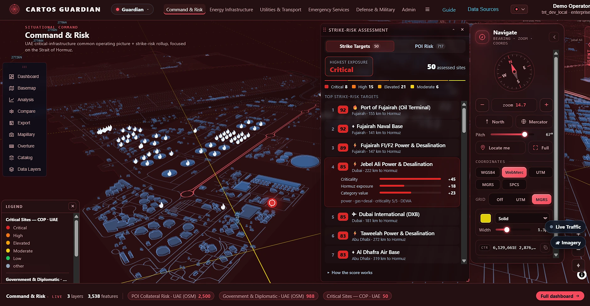
LIVE · africa.cartosatlas.comCritical-infrastructure protection with a transparent 0–100 strike-risk model over 103 curated UAE sites, five domains, live AIS/ADS-B and 3,538 features on one picture.
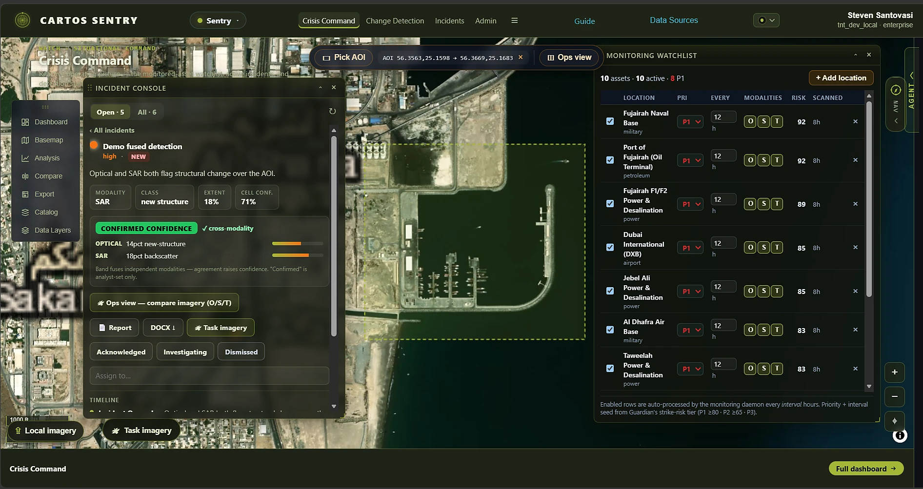
LIVE · guardian.cartosatlas.comThe platform's first background monitoring daemon, real optical/SAR/thermal detectors, cross-modality confidence fusion, an incident state machine and cost-visible commercial tasking.
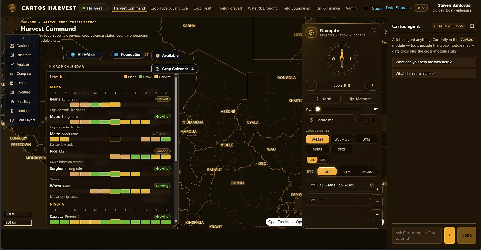
LIVE · sentry.cartosatlas.comSTAC-native agriculture intelligence — crop classification, NDVI-anomaly health, yield proxies with uncertainty, field-boundary delineation and an agri-risk score with an insurance trigger.
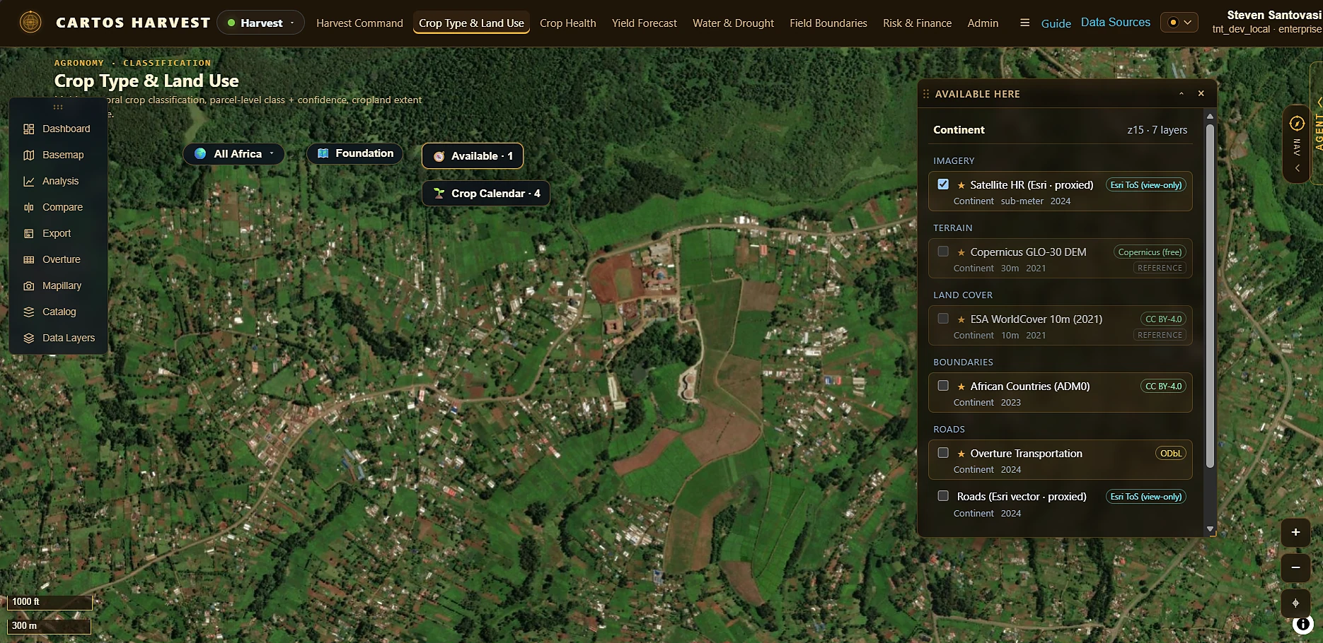
LIVE · harvest.cartosatlas.comRead that cadence again. A continental mapping platform, a strike-risk model, an autonomous satellite-monitoring daemon and an agriculture-intelligence suite — four fundamentally different problem domains, shipped in nine days of each other, by the same engine. Guardian's risk score became Sentry's watchlist priority. Africa's data registry became Harvest's imagery resolver. Nothing was forked; everything compounded. That is the approach, and it is the only part of this that a competitor cannot buy.
What it means for you
Nine editions have already paid down the shared cost — data fabric, agent, symbology, dashboards, admin, field edge. Your edition starts from there, not from zero.
Every engine-level improvement built for any edition lands in yours. You inherit work commissioned by other customers, in other industries, without paying for it.
Sovereign by construction — your own instance, tenant, identity and data, deployed in-territory. Sovereignty is the default configuration, not an enterprise add-on.
Ask-the-map means a policy officer, a field supervisor or a minister's advisor can get an answer without a GIS specialist in the loop — and see exactly how it was derived.
Decomposed scores, earned confidence bands, licence gating in code, and reports that trace back to the imagery and the run that produced them.
Cartos Field stands up offline-first, no-code mobile capture whose ground truth surfaces back inside every module and is queryable by the agent. See it →
Design partner program
We select a small number of design partners with a real, recurring geospatial need and sovereignty as a genuine constraint — and we build their edition on the engine, not beside it. Early access, roadmap influence, and auditable deliverables your stakeholders can defend. Cohorts are deliberately limited and engagements run under NDA.